

")
This story is part of our February 2025 issue. To subscribe, click here.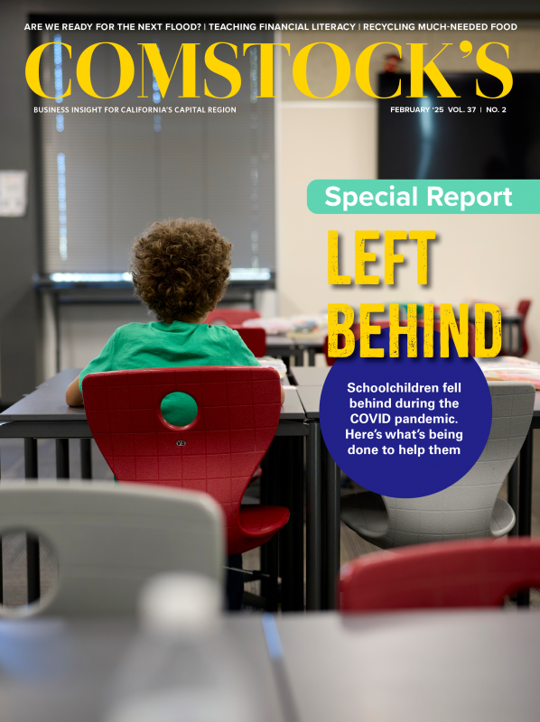
2022 was wrapping up as a very dry year, which is saying something considering all the drought years that preceded it. From April through November, Sacramento received less than 2 inches of rain. Then, the day after Christmas, it started to rain … and rain … and rain … nearly every day for almost four weeks.
Sacramento received more than 9 inches of rain in that time, more than half its annual average in less than a month. Sierra snowmelt added to the mess.
The Sacramento and American rivers bulged, and the Cosumnes River flooded, causing property damage in southern Sacramento County. The scene repeated itself across the state, including south of Fresno, where the long-dormant and once-massive Tulare Lake was brought back to life. Officials declared a state of emergency, and millions of dollars in damage claims were paid.
Much of the precipitation was delivered by atmospheric rivers, essentially rivers in the sky. Atmospheric rivers transport large amounts of water vapor from the tropics and dump it as rain and snow in California and elsewhere. They are responsible for most Central Valley floods. San Francisco and other Northern California locations experienced record rainfall from atmospheric rivers in November 2024.
Climate change is increasing the strength of Sacramento’s winter storms. Higher temperatures allow atmospheric rivers to carry more water, research shows. Climate change is also jacking up other flood risks, such as sea rise and snowmelt. All this is raising the chances of catastrophic flooding in Sacramento, which had one of the nation’s highest risks for severe flooding even before climate change was part of the discussion, experts and government officials say.
“Catastrophic flooding in the Central Valley will occur; the only question is when,” a 2022 report from the Central Valley Flood Protection Board says, pointing to climate change as a major reason. A catastrophic flood would cause billions of dollars in damage and an untold number of deaths. It could dump water 20 feet deep in developed areas, with Natomas, West Sacramento and Sacramento’s Pocket area facing the greatest dangers in the metro area.
“We have to keep the water off the people because it is so cold,” says Rick Johnson, executive director of the Sacramento Area Flood Control Agency, explaining that wintertime river temperatures are cold enough to cause hypothermia and death in a relatively short period. “This is what keeps me up at night. This is what I tell people when I go to Washington, D.C.”
The government is working on an $8 billion project to protect the Sacramento area from severe flooding. The work aims to modernize a flood-protection system that state and federal engineers have found substandard. It involves repairing and securing levees along the American and Sacramento rivers, raising and otherwise improving the Folsom dam, and widening an intake structure on the Sacramento River, among other things.
The work is more than half complete and expected to be finished by the end of the decade. But even if all goes according to plan, a critical question will remain:
Will it be enough when the Big One hits?
Atmospheric rivers caused record rainfall in parts of Northern
California in November. The stormwater led to the rise of the
Sacramento River and a weir, at bottom middle above, opened and
collected some of the water in Sutter County.

Climate scientist Daniel Swain of the University of California Agriculture and Natural Resources has spent a significant amount of the last several years piecing together part of the answer. With funding from the state Department of Water Resources, the Yuba Water Agency and others, Swain and a colleague reinvisioned a study that previously answered a related question: How big of a storm could hit California?
The earlier 2018 study was called “ARkStorm,” nodding to Noah’s biblical flood and atmospheric rivers generally. The report concluded that “Megastorms are California’s other Big One,” capable of unleashing greater destruction than that other Big One, a huge earthquake.
Swain says the original study underestimated the risks because it did not account for climate change. His version of ARkStorm did. Recent climate data was entered into a computer model to simulate what could happen during a multi-day storm like the Great Flood of 1862, which left Sacramento and much of the Central Valley underwater. The study focused on the Sacramento River basin, which includes Sacramento, and the San Joaquin River basin, which includes Stockton.
Swain and his colleague found “climate change has already doubled the likelihood of an event capable of producing catastrophic flooding, but larger future increases are likely due to continued warming,” according to the study, published in Science Advances and reported by The New York Times and other publications.
“What happens when the next real ARkStorm comes, which can mean twice as much rain as we saw in 2023?” Swain asks. His study found that a 30-day storm with rainfall exceeding 20 inches — twice the amount as in December 2022 and January 2023 — in the lower elevations is highly likely.
“I would be willing to bet almost anything that there will be larger floods compared to what has tested this infrastructure historically,” he says.
The problem is that the flood-protection system was designed based on historical records that are incomplete and don’t account for climate change, Swain says. The Great Flood of 1862 was almost certainly the region’s biggest flood but isn’t considered the “flood of record” because rainfall records weren’t kept until the following decade, Swain says. The U.S. Army Corps of Engineers considers the 1986 event the flood of record in the region. Floods have consistently exceeded the Corps’ projections, Swain says. The Corps of Engineers did not respond to repeated requests for comment.
Johnson, the SAFCA executive director, says Swain is partially
correct. Johnson, who previously worked at the Corps of Engineers
and the U.S. Bureau of Reclamation, says the flood-protection
system, conceived in the middle part of the last century, was
based on incomplete data. The corps had flow records from the
American River from 1905 to 1948, and a study from the National
Research Council later found that most of that time was a period
of historic drought.
That helps explain why, from 1950 to 2010, flows on the American
River exceeded protection levels in a dozen years, records show.
Officials have now incorporated climate change into future plans for the Sacramento region, Johnson says. To handle an expected increase in large storms, SAFCA hopes to complete work in addition to what is under construction now, including additional storage at Folsom Lake and three other reservoirs. That work is still in the planning stages. The Corps of Engineers is also planning major improvements at the Yolo Bypass, which is not a part of SAFCA.
As it stands, state law requires protection against a 200-year flood in urban areas. (A 200-year flood is just another way of saying a flood that has a 1 in 200 chance of happening any year.) Officials regularly inspect the levees to see if they meet the standard. The most recent state report on the levees, in 2022, found most of the levees on the Lower American River and on the Sacramento River in the metro area were substandard.
“There are parts that have been deemed acceptable for a 200-year flood, and there are sections that are not acceptable,” says Jane Dolan, chair of the Central Valley Flood Protection Board.
Most of the levees considered substandard in 2022 have since been improved, Johnson says. What remains to be fixed are levees on a stretch of the Lower American River, the Natomas East Drainage Canal, and channels and the Sacramento River in West Sacramento.
Residents rely on government assurances of flood protection when deciding whether to live in a floodplain. Sean Flanagan moved into a house in the Pocket area of Sacramento seven years ago, half a block away from the Sacramento River. He learned about flood protection standards when he worked as a planner for the city of Sacramento, at a time the federal government put a moratorium on development in Natomas because of flood risks. On a recent weekend, he was wearing a green shirt with a clover and “Lucky” printed on it. But he said his faith in flood protection isn’t based on luck.
Construction continues on the expansion of the Sacramento Weir,
which will allow officials to move more water off the Sacramento
River during floods.

“I don’t worry about it, because of all the work they’ve done,” he says. “I’m safe here.”
Levee standards nationwide were updated following the 2005 Hurricane Katrina disaster in New Orleans, “the first time in history that an engineering failure has brought about the destruction or near-destruction of a major U.S. city,” according to a forensic analysis. Levee failures caused catastrophic flooding.
“After the levees in New Orleans, Louisiana, were repaired following Hurricane Katrina in 2005, Sacramento became the nation’s greatest flood risk, which is why Congress funded and authorized this project,” Gregory Treible of the Corps of Engineers said in May 2024, while explaining improvements being made along the Sacramento River.
Sacramento’s “wake-up call” about flood risk happened in 1986, when it narrowly escaped catastrophic flooding from a storm, SAFCA’s Johnson says. Floodwater caused severe damage to the flood-protection system and taught officials about the system’s limits.
Substandard levees allow water to go over or through them, or they sit on land eroding from water and other forces, which could lead them to fail. During the 1986 flood, floodwater sheared away 140 feet of riverbank along the American River near Sacramento State, caused a levee to nearly fail next to a residential subdivision in Rancho Cordova and severely damaged levees along the Garden Highway in Natomas.
In addition to the levee work, officials are making storm protection improvements to better control floodwater. At Folsom Dam, the Army Corps of Engineers has added an additional spillway to allow for quicker release of water from Folsom Lake. Next comes the raising of the dam in several locations. That work will provide more water storage and reduce the possibility of water spilling over the top of the dam.
“We don’t want the dam to overtop, because that greatly increases the chance of dam failure. And we don’t want the dam to fail because that would wipe out the whole metropolitan area from the flooding that would ensue,” Hans Carota of the Corps of Engineers said in a meeting about American River improvements last year.
When a spillway failed at Oroville Dam in 2017, following record winter storms, concern that the dam might fail, too, led officials to call for the evacuation of nearly 200,000 people. The accident was “one of the most serious dam safety incidents in United States history,” according to the Association of State Dam Safety Officials.
Officials are also trying to better manage floodwater by expanding the Sacramento Weir, located near the confluence of the Sacramento and American rivers. Like the work at the Folsom Dam, the weir project is massive, doubling the length of the water intake structure along the Sacramento River. The weir diverts water from the river to the Sacramento Bypass.
The flood protection won’t stop when the weir and other current projects are completed, Johnson says. “I fully expect we are going to see extreme weather more often,” he says. “We have to make sure the system can handle it.”
Stay up to date on business in the Capital Region: Subscribe to the Comstock’s newsletter today.
Recommended For You
")
Stockton Is Behind in Flood Control
While Sacramento, another high-risk city, has invested billions into flood protection, Stockton has not
Stockton’s levees haven’t received a major overhaul since the 1990s, while Sacramento’s have received widespread upgrades in the last 20 years. “We think they’re in danger,” says Jane Dolan, chair of the Central Valley Flood Protection Board. “They’re behind on flood protection.”
")
Drought and Deluge
Experts are racing to protect the Central Valley from a catastrophic flood
Unlike “The Big One” earthquake that is overdue along the San Andreas Fault, experts don’t have an ominous name for a flood of biblical proportions that is likely to inundate the Central Valley within the next 500 years.
")
Sacramento-Area Schools are Still Grappling With Academic and Social Recovery From the COVID-19 Pandemic
Around the Capital Region, schools are still working to recover socially and academically from the COVID-19 pandemic. Test scores have been affected, as has school attendance. A new wave of behavioral issues has unfolded, too. Now, a variety of people are working to help students catch up.
")
What the State Is Doing to Help Education
Efforts by California’s government to help students recover from the pandemic go back to its earliest days, with the state investing more than $36 billion to deal with pandemic impacts. The funding has gone to Learning Recovery Emergency Block Grants, expanded teacher recruitment, literacy specialists and much more.
")
The Pandemic Made Many Parents Get More Involved in Their Children’s Education
“I think what the pandemic really did was just lift the curtain on what was taking place in the classroom and at the administration level for parents to see,” says Justin Caporusso, a Roseville father of four and owner of Caporusso Communications. “A lot of parents saw how much time was spent on classroom management, behavior and really how little time was spent on kind of overall education.”
")
New Year, New Administration. What Can We Expect?
The Capital Region’s economy in the first half of 2025 should be unspectacular but steady, forecasters say
The apocalyptic tenor of the recent election made it seem disaster was inevitable no matter who won. But at least on the economy, the first half of 2025 should be a sigh of relief, letting most businesses stick to small ball.
")
Architects Respond to the Growing Population of Minority, Immigrant and Refugee Students With Culturally Sensitive Design
The influx of immigrants and refugees from a multitude of different countries has created an opportunity and a challenge for Capital Region architects to design educational spaces with greater cultural sensitivity that provide a sense of belonging for new students and families.
")
What’s on the Horizon for California’s Public Lands?
With less funding in the current budget, the management of public lands is likely to change substantially, and this may have massive and unforeseen consequences for Californians.
")
The Power and Potential of Seaweed
From keeping oceans healthy to being used as an alternative to plastics, researchers believe seaweed has a multitude of uses
Nearly 2,000 miles northwest of Sacramento, Matthew Perkins rode a boat out into the Gulf of Alaska and saw nothing but endless potential for growth. “It’s kind of overwhelming how much opportunity there is,” he says. “You’re on the water, snow-capped mountains in the backdrop, you look down and see this incredible biomass growing. It’s literally the bounty of nature.”
")
The Life-Saving Organ Trail
How new technology is helping transplant centers send and receive organs from great geographic distances
In 2022, the United States Food and Drug Administration approved the TransMedics Organ Care System, or OCS device. Known as the “heart in a box,” this device uses normothermic perfusion to pump blood through a removed heart and preserve it for longer periods until it can be transplanted into a new person.
")
AI in Education: Helpful Tool or Sinister Danger?
Most college professors are wary of it, but others embrace it as a learning advantage
All around the world, academic institutions, from the renowned online Khan Academy through to leading research universities, are grappling with the extraordinarily rapid rise of artificial intelligence systems capable of generating human-like responses to complex questions.
")
Speaking Out
Man with ALS is able to ‘speak’ again thanks to neurotechnology from UC Davis
Within minutes, the words he wanted to speak appeared on a monitor and were spoken aloud by a computer in a voice resembling his own using recordings from videos made before his diagnosis. It brought everyone in the room to tears. “On day two of this use by Casey, he was talking to his daughter for the first time in her memory. That was so gratifying,” says UC Davis Neuroprosthetics Lab co-director Sergey Stavisky.