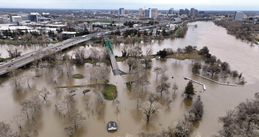
Coming out of the state’s driest three-year period ever recorded, the new year launched a series of atmospheric rivers that pummeled California’s lowlands with rain, hail and violent winds, and packed the Sierra Nevada with near-record depths of snow. This blessing of water will be carried into the dry season, but so will the devastation.
At least 27 people lost their lives due to downed trees and flooding. Destroyed crops, damaged homes and infrastructure will cost billions to repair. This year has been a reminder of the Golden State’s history of drought and deluge, particularly for those who occupy the Central Valley’s floodplains. And while history can show us the humanity of natural disasters — Gov. Leland Stanford famously boated to the Capitol for his 1862 inauguration — experts cannot predict the magnitude of future events. Faced with the unknown, they are fighting a constant battle against climate change, erosion — and rodents — to protect Central Valley residents from a perfect storm.
Unlike “The Big One” earthquake that is overdue along the San Andreas Fault, experts don’t have an ominous name for a flood of biblical proportions that is likely to inundate the Central Valley within the next 500 years — known as a “500-year” flood. Flood events are classified by their Annual Exceedance Probability, which is “the probability that a flood of a given (or larger) magnitude will occur within a period of one year.”
“We’re seeing more extremes. You’re going to have more little years and then more big spikes in between. That’s part of the problem that we have right now, trying to put a frequency, because it’s based on historic record repeating itself, but historic record isn’t repeating itself anymore.” Rick Johnson, executive director, Sacramento Area Flood Control Agency
A 1-percent AEP is referred to as a “100-year” flood, though flood event frequency is in no way dictated by these estimates. Today, 1 in 5 Californians occupy the 500-year floodplain, and some urban areas in the Central Valley are still struggling to achieve 200-year protection as required by the state.
Saving Sacramento
Due to the unprecedented threat caused by climate change, 200-year flood protection isn’t enough, according to Rick Johnson, executive director of the Sacramento Area Flood Control Agency. That’s why his agency will always strive for more.
“We’re seeing more extremes,” he says. “You’re going to have more little years and then more big spikes in between. That’s part of the problem that we have right now, trying to put a frequency, because it’s based on historic record repeating itself, but historic record isn’t repeating itself anymore. To say what a 100-year flood event is with climate change probably isn’t real science. So that’s one of the things we’re trying to get a handle on. But what we do know is we need to get as much resiliency and structures into the system (as possible) to handle these large events.”
Sacramento has been dealing with floods since the very beginning. The city has been identified by the U.S. Army Corps of Engineers as the greatest flood disaster risk in the U.S., with New Orleans coming in second, according to Johnson. The worst flood events in the Central Valley are usually caused by a series of cold storms that build a massive snowpack in the Sierra Nevada, which is then melted by a warmer storm system. The right conditions can cause hundreds of thousands of cubic feet per second of snowmelt to rush down the American River, reaching Sacramento within 24 hours.
“All the streams and rivers that drain from the Sierra Nevada and the coastal range into the Sacramento River system, that all has to get past us to get out under the Golden Gate Bridge,” Johnson says. “The bypass system during large flood events takes 80-85 percent of the flow.”
He adds that “we’re right in the middle of the American River coming down. Downtown Sacramento has actually been raised a whole level over the years to try to combat flooding. It’s a great place to live, a great place to build a city, but from a flood standpoint it’s not a very good spot.”
According to the latest measurements by the California Department of Water Resources, the Sierra Nevada snowpack was at 237 percent of average as of April 1, only the fourth time in state history where the snowpack measurements exceeded 200 percent of average.
SAFCA was formed in 1989 following a record flood a few years prior that exposed weaknesses in the region’s flood control system. The agency serves as a local cost share partner with the state and federal government in funding capital improvement projects, with the sole purpose of protecting Sacramento area residents from catastrophic flooding. SAFCA receives zero tax dollars but collects local funding from property owners who recognize the need and have elected to be assessed for flood risk.
Since SAFCA’s inception, over $2 billion in improvements have been made to the area’s flood control system. An estimated $5.2 billion is now being invested into ongoing projects, with the goal of bringing much of the Sacramento area under 300-year minimum protection. Going further, SAFCA has developed a 500-year plan to better protect the American River channel, widen weirs and bypasses, and increase flood storage.
Johnson credits an explosion in funding to congressional support, particularly Congresswoman Doris Matsui, who has helped secure more than $3.2 billion in federal appropriations since taking office in 2005. Protecting Sacramento is a top priority for Matsui, and with good reason. Due to new urban levee standards and an updated risk assessment for the region, most of Sacramento now falls under less than 100-year flood protection. But that will soon change. Six federally authorized projects to improve levees, a weir, a bypass and Folsom Dam are currently underway — which encompasses the majority of the Sacramento system’s features.
Folsom Dam and Reservoir is being raised 3.5 feet in a $16
million project to allow more water inflows during storms and
increase water storage. (Photo courtesy of Sacramento Area Flood
Control Agency (SAFCA))
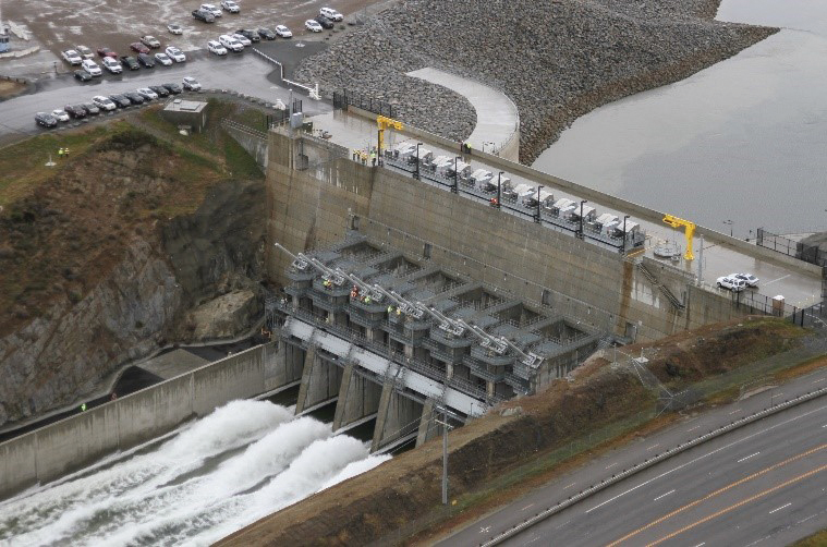
The reconstruction of Folsom Dam and Reservoir has been a monumental feat. The original dam and reservoir have protected Sacramento area residents through the controlled release of snowmelt since the mid-1950s, but in the late 1980s it was determined that improvements were necessary to provide 200-year protection. The reconstruction involves two projects: The main dam and the reservoir’s dikes are currently being raised by 3.5 feet, and in 2017 the new dam and auxiliary spillway were completed — a joint federal project that utilized the equivalent of 4.7 Empire State Buildings in concrete and required the construction of 12 gigantic floodgates that needed a specially made trailer to transport, according to SAFCA. The new spillway has made possible the forecast-informed operation of the dam, allowing operators to anticipate increased inflows during storm events and create more available flood storage space in the reservoir.
Though less visually impressive than dams, levees are the backbone of every flood management system and the last line of defense in protecting communities. A levee break or seepage under or through the levee can quickly engulf entire neighborhoods with frigid water — posing the risk of drowning and hypothermia. Several projects have received federal funding and are underway in Sacramento to prevent seepage and meet urban levee standards. However, securing funds to maintain existing infrastructure is more difficult, says Johnson, and levees require a lot of maintenance to be effective.
Diligence is Key
Tim Kerr knows this well, and he keeps his levees immaculate. As general manager of the American River Flood Control District, he oversees the year-round grooming and inspection of about 40 miles of federally constructed levees in Sacramento — a roughly $3 million annual endeavor. His is one of several districts that operate and maintain the city’s levee system. Because levees are primarily earthen structures, they are subject to the forces of vegetation growth, erosion and rodent activity (a leading cause of levee failures) which all must be kept in check for the system to remain easily inspectable and structurally sound. “It takes about six weeks to mow the entire system, about five mowings per year — about like painting the Golden Gate Bridge,” Kerr says.
During storms, his employees patrol the levees on 12-hour shifts, switching to 24-hour surveillance when flows reach around 35,000 cubic feet per second. “We’ll get supplemental levee patrollers from the County of Sacramento out there with spotlights looking for levee distress all day, all night, and document everything thoroughly. … There’s a hierarchy of flood response — we all work together in different roles.” If signs of seepage appear, the district initiates a flood fight and requests assistance if needed. Fortunately, no such measures had to be taken during the 2023 storms, as flows did not reach levels that would require 24-hour surveillance.
While those who live in a floodplain are made aware through property assessments, Kerr believes most Sacramentans have amnesia when it comes to flood risk. Walkers and cyclists may traverse the scenic byways of the levees without noting the crucial role that they serve. “Not a lot of people think about it, but here in the Sacramento area it is so essential for our region to function and thrive.”
Forever Changed (and Changing)
For those who reside near the confluence of the Yuba and Feather rivers, flood management is hard to forget. The region has suffered seven major floods within the span of a lifetime, partly due to Gold Rush-era hydraulic mining practices that clogged the riverbeds with debris. Some still remember the levee break on the Feather River that caused one of the worst flood disasters in U.S. history: Christmas Eve 1955, in the dead of night, Yuba City awoke under five feet of water. Families fled their ruined homes, some knocked off their foundations. Thirty-eight people drowned.
Four years later, Yuba Water Agency was formed with a primary mission to protect residents from flooding. Then, an astounding 92 percent of Yuba County voters approved $185 million in revenue bonds — three times the county’s total assessment at that time — to build the Yuba River Development Project. The largest public works project in California ever to be led by a public agency, it included the construction of New Bullards Bar Dam as well as several other dams and powerhouses. PG&E would later step in as financier for the project, so residents no longer had to foot the bill. Nonetheless, their commitment made progress possible, and today Yuba Water Agency is primarily funded through hydropower production and water transfers.
Yet in February of 1986, after nine days of rain, a section of levee disintegrated due to underseepage, allowing floodwaters to overtake roughly 10 square miles of land around Linda and Olivehurst. Two people died, and property damages totaled more than $464 million. In response, Yuba Water Agency along with the State of California and USACE developed the Yuba River Basin Project, which would greatly strengthen the levees. Before those improvements could be made, another major flood in 1997 further devastated Arboga (now Plumas Lake) and Linda, claiming three lives and inflicting more than $300 million in damages.
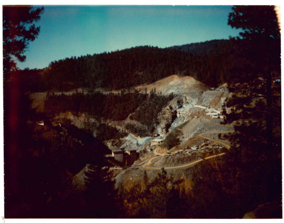
New Bullards Bar Dam was the fourth dam to be constructed on the
Bullards Bar site of the North Yuba River. It was completed in
1970. A source of drinking water, electricity and recreation, New
Bullards Bar Dam and Reservoir can hold up to 969,600 acre feet
of snowmelt. (Photo courtesy of Yuba Water Agency)
Today, nearly all urban areas in Yuba County enjoy 200-year flood protection — making it one of the best protected areas in the state, though residents still get nervous during storm events. Towns have yet to recover economically. Even those newly settled in the area are haunted by a collective trauma that hovers like a storm cloud.
Flooding “is a very emotional topic in Yuba County,” says Ryan McNally, director of Water Resources and Flood Risk Reduction for Yuba Water Agency. “I’m a product of that. I’ve lived through three flood events, and each one changed my life in different ways. It’s very visceral, and it’s without a doubt a top priority for people in Yuba County. … It’s part of our fabric. It’s our culture.”
Yuba County’s refusal to accept flooding as an inevitable risk has paid off. But that doesn’t mean the work is done for agencies like Yuba Water, which just finalized a new comprehensive flood study. The plan includes a second spillway at New Bullards Bar Dam that would allow for forecast-informed reservoir operations and more flexibility to release water before large storms. The spillway is in the final stages of design, and Yuba Water is “actively seeking funding partners” for the project.
“The plan kind of fleshed out a lot of projects that we think are needed to address these extremes that we’re seeing now, especially from year to year,” says McNally. “If there’s one thing for certain, it’s that uncertainty.”
–
Stay up to date on business in the Capital Region: Subscribe to the Comstock’s newsletter today.
Recommended For You
Perspective: California’s Long and Complicated History With Water
The battle for more water has been fought for decades with no solutions
From 19th century battles between farmers and hydraulic gold miners over debris polluting rivers to 21st-century political duels over spawning salmon, Californians have squabbled incessantly over how water should be captured, allocated, conveyed and priced.
Could Agave Spirits Be a Sustainable Gold Rush for California?
Hardy plants could solve water crisis for farmers and give distilleries a big opportunity
Northern California’s agave pioneers are helping to evolve the crop from a novelty to a force of stability within California’s changing bread basket.
Fuel From the Forest
Can bioenergy technology combined with innovations in finance fuel forest restoration in the Tahoe National Forest?
A new project in the North Yuba Forest is developing a local economy built on wood and other biomass clogging the forest.
Who Will Save (Not Stop) the Rain?
California has always been celebrated for Innovation, yet we can’t budge our elected leaders to truly innovate much of anything, states Comstock’s president and publisher. In this month’s letter, she considers the complicated issue that is our state’s water dilemma.


