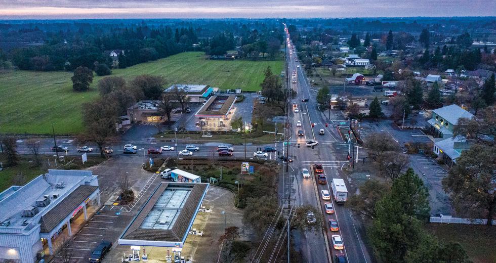
Grant Line Road traverses almost 20 miles east from Highway 99 in Elk Grove before turning north and merging with White Rock Road, which winds another 9 miles to Highway 50 in El Dorado Hills. Along the way, Grant Line passes the historic agricultural communities of Sheldon and Wilton on either side of the Cosumnes River, small subdivisions, farms, vineyards, lone country houses, and quarries. White Rock Road winds through what is now mostly rangeland, and winds up in what will soon be vast housing developments in Folsom.
Stitching together rural and suburban areas from near the Delta to the foothills, these two country two-lanes also connect the area’s past and future. The 15,000 vehicles that crowd this route every day might be traveling from a home in Elk Grove to a job in Rancho Cordova, or from a condo in Rancho Murieta to the Palladio in Folsom. Midday, when the traffic is thin, farm trucks, tractors and livestock trailers use these roads as they have for more than half a century.
In recent years, the traffic on this route, and on similar country thoroughfares throughout the Capital Region, has included folks who’ve moved from Sacramento into the surrounding countryside and still do daily business in the city. Transportation experts agree that while there are no studies confirming this, anecdotal evidence suggests urban expats, scattered to the countryside by high housing prices, empty-nest syndrome or a desire for a pastoral lifestyle, are helping clog local roads.
A November 2018 regional transportation study by the Sacramento Area Council of Governments shows that, surprisingly, rural and urban residents in our six-county region spend the same amount of time behind the wheel (22 minutes per day), with urban drivers making an average of 3.8 trips versus rural residents’ 3.0. Caroline Rodier of the UC Davis Urban Land Use and Transportation Center says it would be useful to pinpoint the origins and destinations of those trips, and that the trend is ripe for study. She says she attempted to develop land use and transportation models answering this question some years back, but funding dried up.
“It is very hard to get data on where people are relocating and where they are working,” she says. As a transportation analyst with 20 years in the field, and as a longtime Sacramento resident, Rodier believes some version of urban flight is contributing to roadway congestion.
Rodier suggests the situation has been amplified in the past couple years, as housing prices in the central city have continued to climb. “My feeling is that more and more people want to live here (central city),” she says, “especially young people, but it’s expensive, and they just can’t afford it.”
Sacramento County Supervisor Don Nottoli, whose District 5 stretches from the Yolo and San Joaquin county lines to Amador County, says he is hearing from his rural constituents that traffic congestion is increasing. Nottoli points to a traffic survey by the County and the California Highway Patrol in Walnut Grove last summer. “For years, I’d been quoting a number of about 7,000 cars a day coming through Walnut Grove,” he says. “The summer of 2018 survey counted approximately 10,700 vehicles.”
Nottoli relies on stories he hears at town hall meetings and what he sees on the roads. The Galt native who now resides in that community’s rural outskirts says he has seen traffic congestion increase in recent years, and he’s concluded that a considerable percentage is from new arrivals to his district with jobs or other business in Sacramento. “We’re not seeing the development pressure we saw 20 years ago, of dividing up large ranches or farms,” he says. “But we are seeing growth in areas where historically you had a fairly modest population. If someone, for whatever reason, maybe it’s financial or maybe they want a little bit more acreage, moves out to Wilton or outside of Galt, that’s a conscious choice, and then they’re going to have to make the commute.”
However, Nottoli suspects that suburbanization is not the main culprit when it comes to the increased traffic pressure on country roads in his district, especially in the Delta. He points out that every driver on Interstate 5, Highway 160, Highway 12, etc., has GPS or an app that is taking them off highways and onto rural roads, “which really weren’t designed to take thousands and thousands of cars a day.”
Rural Highway
The Capital SouthEast Connector, an expressway that will originate at the Hood Franklin Road I-5 interchange and follow Kammerer Road to Highway 99, and then trace the route of Grant Line Road and White Rock Road to Highway 50 in El Dorado Hills, is the largest transportation project in the Capital Region by any measure. When the 34-mile parkway was conceived in the early 2000s, it was intended to alleviate congestion and safety issues on the country roads as much as to get cars off the highways.
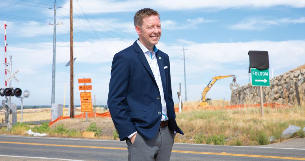
Derek Minnema, executive director of the Capital SouthEast Connector Joint Powers Authority, says that almost two decades later, that’s still the case. In addition to deteriorating pavement and severe lack of capacity along the current route, he says, the “roller-coaster” effect caused by mid-20th century engineering is dangerous. “It just goes with the terrain — up and down, left and right,” Minnema says. “It was designed for agrarian vehicles. This is not a facility that accommodates today’s travel demands.”
As executive director of the Capital SouthEast Connector Joint
Powers Authority, Derek Minnema oversees the largest
transportation project in the Capital Region. (Photo by Andrea
Price/Sacramento State)

Similar situations can be found throughout the region, but probably none as notorious as this corridor. Minnema points to Rancho Cordova, which over the past 15 years has turned into a major job center. “There are 60,000 jobs in Rancho Cordova,” Minnema says. “It’s essentially equal to the downtown (Sacramento) core.” While that traffic causes congestion on Highway 50, he says, “Today, the alternative route is a two-lane country road.”
At the same time, he says, the roads are still used for their original purposes. There are thousands of acres of vineyards and other crops along the route; therefore, there are “a lot of agricultural goods trying to get to market.” There are big trucks hauling from working quarries and to the county landfill.
Minnema says, like every highway, the characteristics are determined by land use. The conference room in the Capital SouthEast Connector’s office on Mather Boulevard features a long wall with a half-dozen large maps, tracing the route from the valley to the foothills, color coded to indicate existing uses, planned developments and approved projects. Large chunks of property on either side of the expressway are green and purple, indicating existing and planned open-space preserves.
The preservation of open space is among the primary goals in the original project documentation, and before that in proposals leading up to 2004’s Measure A, the voter-approved sales tax measure that contributed $110 million toward the $456 million price tag. (Most of the cost is being covered by developers’ fees and federal and state highway funds, including money made available by Senate Bill 1, the $54 billion Road Repair and Accountability Act of 2017.)
The preservation of open space, including wildlife habitat and farmland, is also spelled out in the South Sacramento Habitat Conservation Plan, which was written in 2018 following a 20-plus year collaboration by the SouthEast Connector JPA, Sacramento County, the U.S. Fish and Wildlife Service, the California Department of Fish and Wildlife, and other local agencies. The plan streamlines permitting processes to ensure that developments in the region adhere to regulations in the Clean Water Act and the Endangered Species Act.
To mitigate for environmental disruption caused by the construction of the expressway, the JPA has spent $5 million to preserve and restore significant agricultural, rangeland and undeveloped acreage, and will spend another $13.5 million in coming years. The conference room map shows that when the project is complete, including the purchases of properties and easements to preserve these open spaces, the expressway will wend past open areas including farms, grasslands, wetlands and purposely interconnected wildlife corridors.
The Environmental Council of Sacramento worked closely with the agencies that created the Habitat Conservation Plan. When it was released, ECOS board member Sean Wirth said in a story published by the U.S. Fish & Wildlife Service that the process resulted in “a preserve network” that “will be big enough and interconnected enough that those resources will be secure.”
Minnema, a civil engineer by training, points out that this network of open spaces also brings efficiencies to the parkway as a transportation mode. Highway planning, he explains, is “exactly the opposite of mass-transit planning.” Whereas buses and trains need sufficient population density to provide ridership, a highway works best when the population is thin enough to avoid congestion.
And so this nearly half-billion-dollar project, designed to enable, among other things, explosive residential growth in the terminus communities of Elk Grove and Folsom, is also expressly working to ensure that it helps the area retain some of its rural character.
Trees and Buses
Even in a rural setting, increased population density can be a benefit to mass transit. And as more people are choosing to live in places that force them to commute, their options are improving.
Keith Martin, manager of Yuba Sutter-Transit, says when those counties experienced a population bump a decade or so ago, his agency was able to vastly increase its offerings. For a number of years, YST’s commuter service to Sacramento, launched in 1990, got by with two 15-passenger vans. Beginning around 2006, it started adding full-sized buses and now runs 13 touring-style buses that each seat 57 passengers and run a total of 23 routes a day.
Martin surveys his riders from time to time and says he has seen their commutes getting longer. “They come from all points on the compass, and they’re coming miles to get to our parking lots. They’re coming from Live Oak, from Wheatland, from the foothills, from Oroville. We’ve got folks commuting from Chico, Colusa County and even a few from Nevada County. Our survey shows that 10 percent of my passengers are from outside Yuba and Sutter counties.”
Rodier of UC Davis is well aware of this trend and has been devoting most of her efforts lately to helping solve the rural commuting problem. In November 2019, she completed an application to the U.S. Department of Energy to help expand a rural electric-vehicle car-sharing project, which is already serving communities outside Visalia and Bakersfield — areas that, like parts of the Capital Region, “are really hard to get to by transit or to provide high-quality transit that will actually be used.”
The pilot project was funded with a small portion of the $1.4 billion California Climate Investments program — cap-and-trade money allocated to offset carbon emissions. The federal dollars Rodier seeks from the DOE will allow her project to expand to provide a volunteer ride-hailing type service. The Urban Land Use and Transportation Center, partnering with nonprofits and private companies, has developed its own app and hopes to spin off a for-profit enterprise in the just-emerged rural car-sharing field. “This is still brand-new,” Rodier says, “but it’s an amazing opportunity.”


